 |
 |
 |
 |
 |
 |
 |
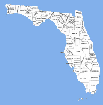
Anastasia Formation crops out in a narrow belt along the eastern coast of Florida, from the Anastasia Island (where the name was given to the formation by E. H. Sellards in 1912 – the stratotype) in St. Johns County, opposite to St. Augustine, in the North, to Boca Raton in Palm Beach County in the South, a distance of more than 320 km. Exposures of the Anastasia Formation are found along the ocean, under water on the shelf, on the barrier islands, and in the Intracoastal Waterway.
The basal portion of the Anastasia Formation is not exposed at any locality along Florida’s East Coast. Presumably it rest uncomformably on Caloosahatchee marl. South of Boca Raton, the Anastasia Formation grades into Miami Limestone, which has been dated as 130,000 years old. The age of the Anastasia Formation has been traditionally estimated to be 130,000 to 100,000 years old (Illinoan – Sangamonian). The Anastasia Formation is probably the youngest lithified marine Pleistocene deposit found in the coastal areas of Florida Peninsula. It believed to grade inland into a shell-in-quartz sand facies with thin discontinuous limestone beds. Thickness of the Anastasia Formation may exceed 30 m in some places. It is overlain by Pamlico sand (unconsolidated quartz sand), mud or peat (Everglades muck).
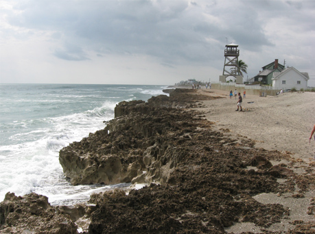
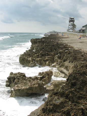
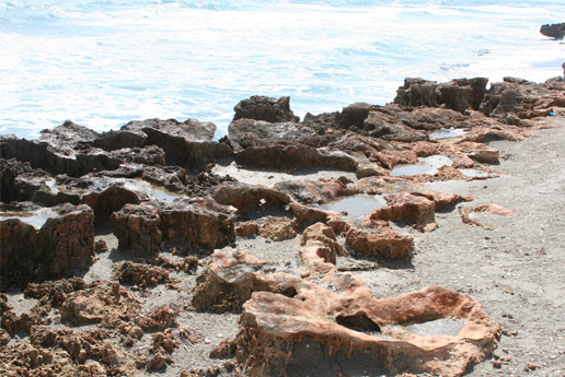
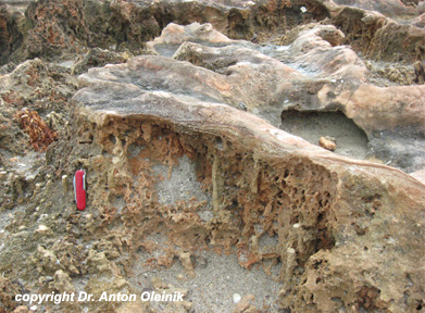
The Anastasia Formation in Martin and Palm Beach Counties is Exposed in several spots and represented by a variably sandy coquinoid limestone. When first cut, the rock is quite soft, but upon exposure to the atmosphere its surface become case hardened, making possible the development of sea cliffs in many outcrop areas.Among the most notorious geologic and sedimentary features of the Anastasia Formation are bioturbation with variable size burrows, laminated crusts, known as Caliche, solution holes, wave cut niches, and lithified infillings.
Home - Geological Definitions - Geological Supplies - Submit Location - Travel - United States - Contact
Copyright © 2007-2022 geologicallocations.com. All Rights Reserved.
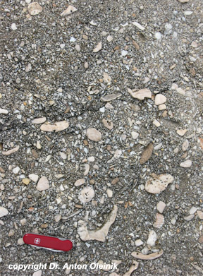
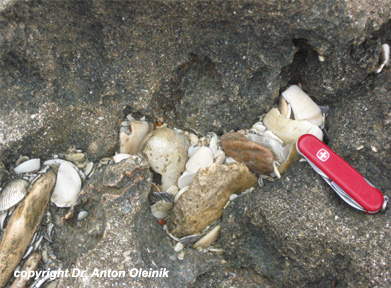
Very coarse imbricated coquina of the Anastasia Formation. Notice that larger and thicker fragments (Busycon and Mercenaria) are commonly bored. House of Refuge, Hutchison Island, Stuart, Martin County, Florida.
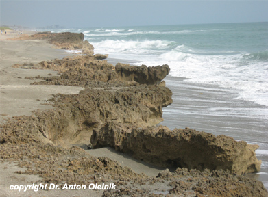
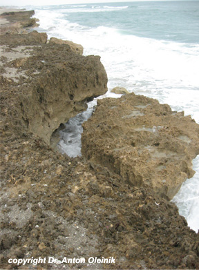
Wave-cut cliff of the Anastasia Formation is being constantly eroded by wave action. Collapsed wave-cut niches are common along the shoreline.
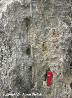
Long vertial Rhizomorph from a root of a plant or Ophiomorpha burrow in the coquinoid limestone. House of Refuge, Hutchison Island, Stuart, Martin County, Florida.
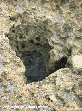
Solution hole through the coquinoid sandy limestone. These holes are also known as "Blowing holes". House of Refuge, Hutchison Island, Stuart, Martin County, Florida.
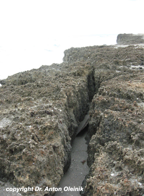
Freshly collapsed piece of the Coiquinoid limestone cliff. House of
Refuge, Hutchison Island, Stuart, Martin County, Florida.
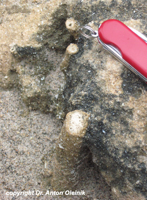
Large horizontal burrow in the coquina. House of Refuge, Hutchison
Island, Stuart, Martin County, Florida.
Close-up view of the crack formed during the collision of the wave-cut niche. House of Refuge, Hutchison Island, Stuart, Martin County, Florida.
Vertical Rhizomorph from a plant root or Ophiomorpha burrows. Notice that the filling of the burros is different from the surrounding rock. House of Refuge, Hutchison Island, Stuart, Martin County, Florida.
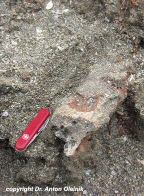
close-up view of forming lithified infillings. House of Refuge,
Hutchison Island, Stuart, Martin County, Florida.
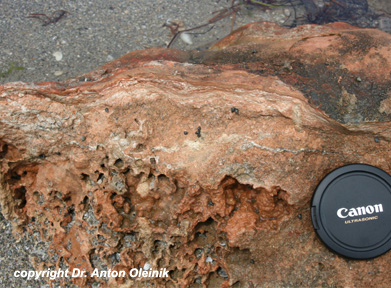
Close up view of the cut through the Caliche Crust. Note the
layered nature of the top portion. House of Refuge, Hutchison Island,
Stuart, Martin County, Florida.
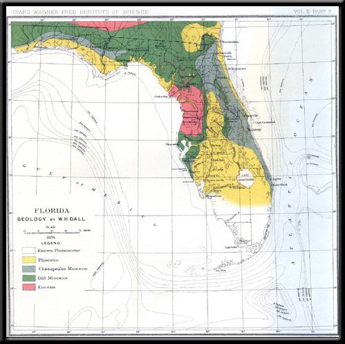
Old map of Florida from 1891. Shows how geology has progressed since then. By W.H. Dall, published in 1892