 |
 |
 |
 |
 |
 |
 |
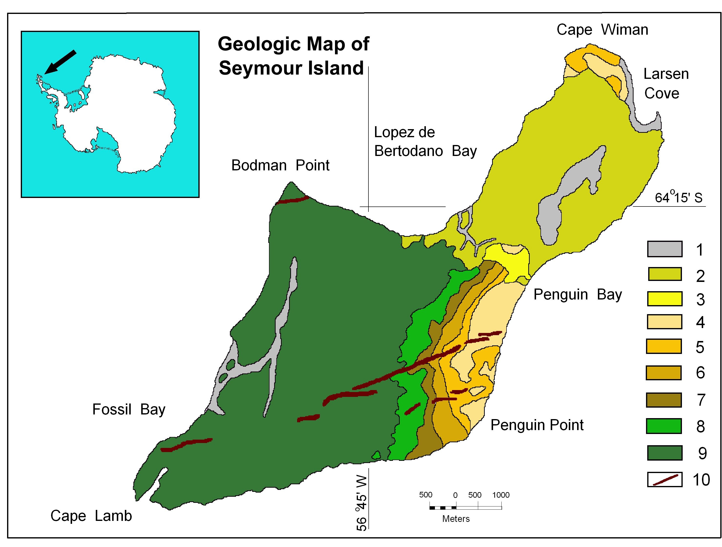
Geologic sketch map of the Seymour Island, Antarctic Peninsula. Legend: 1 – recent fluvioglacial deposits, 2 – La Meseta Formation (Eocene), 3 – Cross valley Formation (Early late Paleocene), 4 - Sobral Formation, unit 4 (Early Paleocene), 5 – Sobral Formation, unit 3 (Early Paleocene), 6 – Sobral Formation, unit 2 (Early Paleocene), 7 – Sobral Formation, unit 1 (Early Paleocene, 8 – Lopez de Bertodano Formation, unit 10 (Late Maastrichtian – Early Paleocene), 9 – Lopez de Bertodano Formation, units 1-9, 10 – Basaltic dikes.
Home - Geological Definitions - Geological Supplies - Submit Location - Travel - United States - Contact
Copyright © 2007-2021 geologicallocations.com. All Rights Reserved.